Friends of Woodthorpe Grange Park 2023
The Meadows Nottingham: An Historical Timeline
Return
October 10th, 530: The lowland extending from the Leen river to the River Trent. The first record dates back to 530 AD.
1505 — 1550 The Meadows as a meadow: For centuries, the Meadows area was actually a meadow. It was known as the Wilford Meadows and then the Cottagers Meadows. In between flooding episodes, it was allotted for local burgesses who grew vegetables and kept a limited number of cattle.
1683 Flooding: The flooding of 1683 was caused by frost; it locked the River Trent in September 1682 and continued until February 1683 without a break in the weather. The ancient Trent Bridge was severely damaged by breaking ice had to be extensively repaired.
1792: The Nottingham Canal was opened and connected the Derbyshire waterways with the town of Nottingham.
1795 Flooding: The waters reached the highest levels ever.
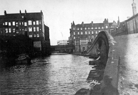
Nottingham Canal looking towards Carrington Street

Nottingham Date Book 1795
1815, The Meadows as communal land: In 1815, The Meadows in Nottingham was largely an area of marshland or wetland, extending from the River Leen to the River Trent. While it wasn't specifically described as communal land in the same way as formalised common lands, it was used for various purposes, including grazing livestock, collecting firewood, and potentially other traditional rights. The area wasn't yet heavily developed and was transitioning from its natural state to being used for various purposes, including the beginnings of residential and industrial development.
1832 Outbreak of Cholera: In 1832, a cholera epidemic raged in Nottingham. Significantly, its first victim was a Mr T. Farnsworth of Lees' Yard, off Narrow Marsh. It was mainly among the poor of these court warrens that the disease spread until it affected some 1,000 people and caused nearly 300 deaths.
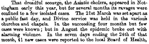
Nottingham Date Book 1832
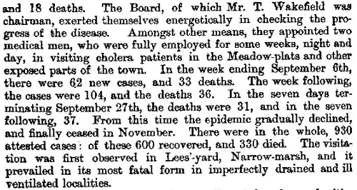
1839 Nottingham’s First Railway Station: Nottingham's first station was Carrington Street station, which opened in May 1839, when the Midland Counties Railway opened the line from Nottingham to Derby. This terminus station was situated on the opposite side of Carrington Street from the current station, on a site now occupied by Nottingham Magistrates' Court. The original station gate posts still exist and form the pedestrian entrance to the Magistrates' Courts area.
1839 Queen’s Road Terminus
© Nottingham Historical Film Unit
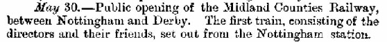
Nottingham Date Book, May 30th 1839
Carrington Street: The site of Nottingham’s First Railway Station of 1839

1839: Train Entering Nottingham through the Meadows
© Nottingham Historical Film Unit
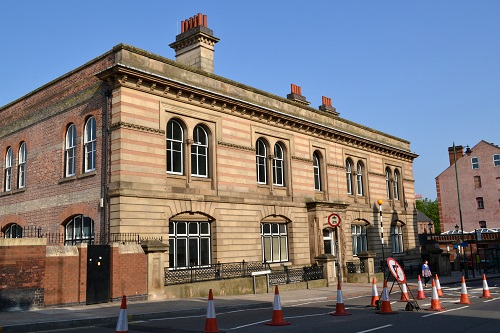
Crocus Gathering, The Meadows
© Nottingham Historical Film Unit
1839 Petition for Meadows development: The Nottingham Corporation petitioned to enclose part of the Meadows for development, but this was refused despite having the advantage of having a major railway station on the site.
First Residential Development in the Meadows in 1845: The Nottingham Enclosure Act, which received Royal Assent on June 30, 1845, marked the beginning of the first residential development in the Meadows. This act aimed to address housing shortages and improve the quality of living conditions within the city. The enclosure of the surrounding fields, including the Meadows, was seen as a way to provide land for building and ease congestion, which paved the way for future development in the area.
1845 — 1901: Development of Recreational Areas in the Meadows: Large emphasis was placed on recreational areas, particularly along the riverfront. The embankment was the subject of major investment, and large green areas were created.


1848: The Second Midland Railway Station opens: Nottingham’s second Midland Railway Station opens. Situated on Station Street, opposite Trent Street. Covering an area of 600 feet (182 metres) by 94 feet (28 metres), the station had three stone platforms which were roofed over and provided with waiting rooms, toilets and refreshment rooms.
View from the Carrington Street Bridge, Scenes during the Floods of 1875
© Nottingham Historical Film Unit

1848: Nottingham Second Midland Railway Station
© Nottingham Historical Film Unit
1864 Building of St. Saviour's church: St. Saviour's Church in the Meadows, Nottingham, was built between 1863 and 1864. It was designed by architect Richard Charles Sutton and funded by the Ecclesiastical Commissioners. The church was opened for worship in 1864 and replaced a smaller existing mission chapel that was deemed insufficient for the growing population.

St. Saviour’s Church, Arkwright Walk
1864: Notts County Football Club, now universally recognised as the world’s oldest Football League club, was formed in 1862. Official formation followed two years later as the Notts Football Club.
Pre-dating the Football Association, the club initially played matches of its own devising at Park Hollow, inside the grounds of the old Nottingham Castle. In 1864, the decision was made to take on outside opposition from both England and Scotland, which led to a move away from the club’s initial home to allow for larger crowds.
The following years saw the club appear at numerous locations, including Castle Cricket Ground (1894), Nottingham Forest’s Town Ground (1895 and 1896) and City Ground (1899 to 1909). However, the club’s main home, from 1883 onwards, was Trent Bridge, until the permanent switch across the river to Meadow Lane was completed in 1910.
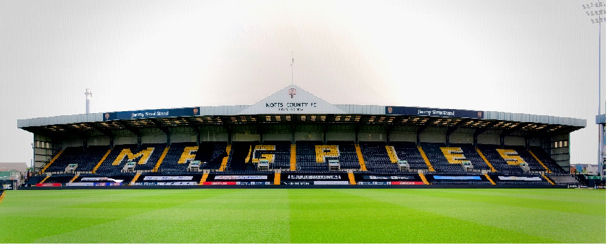
2025: Nott’s County Football Stadium, Jimmy Sirrel Stand
1870: Building of the Pilgrim Church. Also in 1870, apart from the building of St. Saviour's Church, Clifton Colliery was opened. Referred to as Black Sally Pit, the business was run as a private concern by Saul Isaac as the proprietor. However, in 1876 Clifton Colliery Company was formed under the chairmanship of its original proprietor, Saul Isaac. The Company took over the lease of Wilford Bridge and thereafter received the collected tolls. By the turn of the 20th century, the Clifton Colliery Company had become the biggest employer of Labour in the Wilford and Meadows area, finding work for about 1,000 men and boys, and supplying roughly 300,000 tons of coal per year.

1895: Clifton Colliery
© Nottingham Historical Film Unit
1870, 16th June: In front of a crowd of between 20,000 to 30,000 spectators Wilford Toll Bridge is opened by Lady Clifton.
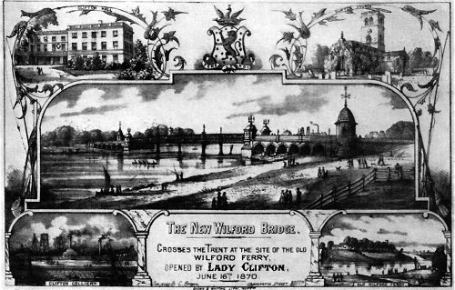
A print published to celebrate the opening of Wilford Toll Bridge
© Nottingham Historical Film Unit
1871 – 1872: Out of a population of 137,614, during a smallpox epidemic of 1871-72, there were 500 recorded cases.
1875: Flooding, February 9th 1875: After a six-week period of continuous frost, the ice on the River Trent suddenly started to melt as the result of a very rapid rise in temperature. All the valleys in the counties of Staffordshire, Derbyshire and Nottinghamshire soon became beds of roaring torrents, which swept them great sheets of ice, timber and livestock into the Trent. Once more, the unfortunate inhabitants in the Broadmarsh area of the town were imprisoned in their houses by water over four feet in depth. The losses sustained by flooding were so severe that a public subscription was raised to assist those who had suffered the most because of the flooding. Many cattle, sheep and horses were drowned in the parishes of Wilford, West Bridgford and Lenton; almost 400 sheep perished in Lenton parish alone. The disaster seems to have been the worst on record; it has since been estimated that the level of water was 14 inches above that of the subsequent flood of 1852, and 10 inches higher than that of 1895.

The Great Flood of October 1875, viewed from the Castle Rock
© Nottingham Historical Film Unit
Houses all over the Meadows were flooded to a depth of six feet, and people moved about in boats or on hastily prepared rafts; six residents were drowned. Railway services to Trent Head had to be diverted via the Derby, Codnor Park and Mansfield lines.
1878: The Nottingham and District Tramways Company’s first routes were opened on Thursday, 17th September 1878, when two services were started: St. Peter’s Church to Trent Bridge via Carrington Street and Arkwright Street; and St. Peter’s Church to London Road via Carrington Street and Station Street. These services connected the town with the two main railway stations of that day, the Midland Station on Station Street and the Great Northern on London Road, and were operated by eight single-deck trams purchased from Starbucks of Worcester.
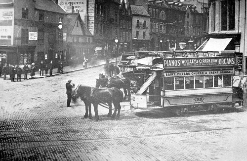
St. Peter’s Square and Wheeler Gate
©Nottingham Historical Film Unit
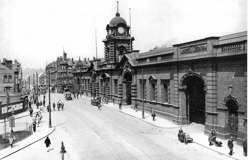
1886: The Cattle Market, on East Croft, was erected in 1886, at a cost of £32,000, from designs by the City Engineer, Mr. Arthur Brown M. inst, C.E. The building and enclosures occupy and area of 7 acres; the principal entrance is from London Road by a bridge over the canal 60 feet in width; the other entrance is from Meadow Lane. The market is laid throughout with cement concrete pavement, and the drainage is thoroughly efficient; railway sidings, provided with separate pens for the collection of stock, are in direct communication with the Midland, Great Northern and North Western Railways. Sheep and cattle markets are held on Wednesday, for fat stock only, and Saturday for stores. The Horse Fair and the hay and straw market is about 1 ½ acres in extent, with weigh-house specially adapted for weighing livestock and farm produce; provision is made for stalling; there are stalls for 350 beasts, 2,500 sheep, 450 pigs and calves, and on the north side of the market are a number of covered lairs; a large area is set apart for auction purposes, room being provided for six auctioneers, with pen for 700 beasts.
The buildings are constructed of red brick with Hollington stone dressings. There are offices for the market inspectors, rooms for the paying of money, and refreshment rooms and lavatories, as well as offices for the banking agencies here.
The markets are the property of the Corporation (which takes the tolls) and are under the care of the clerk of the markets, who is appointed by the Corporation. The Hide, Skin and Fat Market is in Poplar Square; sales are held every Friday at 3.30 p.m.
(Wrights Directory of Nottingham 1910 – 1911).


1950's Cattle Market
© Nottinghamshire Live
Example of Main Entrance Gate Post, Meadow Lane
1887 Meadows area expanded: In 1887, The Meadows was fully incorporated into the Nottingham Borough, marking a significant stage in its urban growth. The areas included in the borough expansion were Kings Meadow and North Wilford.
1901: The Electric Tram service rapidly expanded with the electric tram line service to the Meadows and Trent Bridge beginning on the 21st October, 1901.
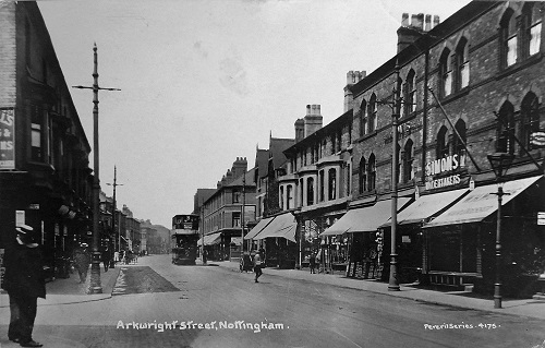
1910: Arkwright Street

Trent Bridge Depot completed in September 1901
©Nottingham Historical Film Unit
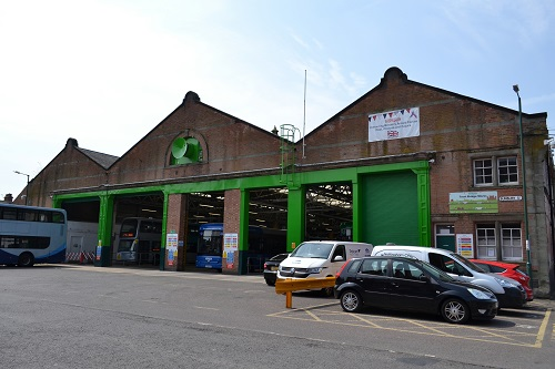
Trent Bridge Depot 2025
The Trent Bridge Depot, which was opened in September 1901 was built to hold a further 80 trams due to the services rapid expansion. The Depot was built on the site of the old Nottingham Forest Football Club’s Town Ground on Bathley Street, where the last game was played by Forest on the 28th April 1892.
25th July 1901: Alderman Lambert declared the new Victoria Embankment open to the public.

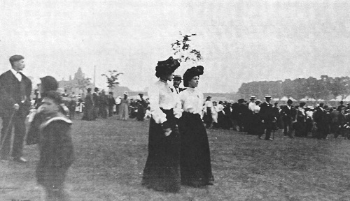
Alderman William Lambert addressing the crowd, while the Mayor Alderman F. R. Radford looks on.
©Nottingham Historical Film Unit
People of Nottingham enjoying a stroll on the new embankment
©Nottingham Historical Film Unit
1901: The Central Railway's goods office at Queens Walk in Nottingham is opened. The building, located at Queens Walk in The Meadows, and its associated sidings, are thought to have opened at the same time. The area was previously known as Queens Walk but was renamed Queens Drive in 1926.
Great Central Railway Parcels Office, Queens’ Walk
© Picture the Past
1904: Midland Railway Station in Nottingham, now known as Nottingham Station, officially opened to the public on January 17, 1904, though completion wasn't until later that year. It was built by the Midland Railway and replaced the original station from 1848. The station is a significant example of railway architecture and has survived well.
Midland Railway Station
1911: 6th December 1911, International rugby was played at Meadow Lane; England 5 points Australasian's 3 points.
1914: Portland Baths, now known as Portland Leisure Centre, opened in 1914 as a public wash and bathhouse. It later underwent a major renovation in 1983 and reopened as a leisure centre with a 30-meter swimming pool and other amenities.
Portland Baths
August 1914: The United Kingdom entered World War I on 4 August 1914, when King George V declared war after the expiry of an ultimatum to the German Empire.
5,370 men from Nottingham lost their lives during World War One. By 1921 the city’s General Hospital was still treating 18,400 disabled servicemen. During World War One, 2,500 children from the city lost fathers during the conflict with many thousands more left grieving for brothers and other relatives.
1915 World War One: 15th July: Cammell Laird & Co Ltd were asked to build and manage a National Projectile Factory. On the 23rd of July, the firm produced a scheme and preliminary estimates for a factory to produce 2,000 9.2 ins. and 6,000 6 ins. shells per week. The National Projectile Factory later became the Royal Ordnance Factory, parochially referred to as “The Gun Factory.”

National Projectile Factory Employee
© Wikipedia
1916: The Meadows in Nottingham were bombed during World War I. Specifically, on September 24th 1916, when German Zeppelins dropped bombs on the area, causing extensive damage. The attack targeted areas from Eastcroft through to The Meadows, reaching Nottingham Midland Station and beyond.

WW1: The Bombing of the Meadows
© BBC Archives
1916: 16th December, King George V visited local munitions factories in Nottingham as part of his wartime duties. This visit was one of many made by the King and Queen during World War I to boost morale and show support for the war effort. The visit to the munitions factories highlighted the importance of these facilities in producing supplies for the war.
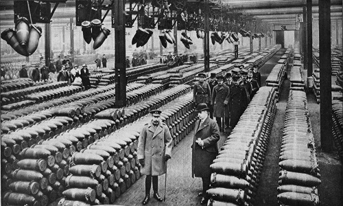
King George V visiting munitions factories in Nottingham
© https://commons.wikimedia.org/
1918: November 11th at 11 am the guns on the Western Front of Belgium and Northern France after four years of continuous fighting fall silent as the Armistice signed by the German Forces in a railway carriage at 05.45 that same morning in Compiègne, France, in the Rethondes Clearing came into effect.
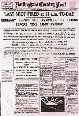
Nottingham Evening Post
11th November 1918
1919 Housing Town and Planning Act: The 1919 Act - often known as the ‘Addison Act' after its author, Dr Christopher Addison, the Minister of Health.
The 1919 Housing Town and Planning Act was designed to address the huge demand for working-class housing in towns throughout the UK. The ambitious Housing Act promised government subsidies to help finance the construction of 500,000 houses within three years. However, as the economy rapidly weakened in the early 1920s, funding had to be cut, and only 213,000 homes were completed under the Act's provisions.
Between 1919 and 1930, there was a plan to build 17,483 council homes in Nottingham, of which a small number were in the Meadows on vacant land adjacent to Holgate Road.
1920: In 1920, Jesse Boot purchased land adjacent to the Victoria Embankment in Nottingham and donated it to the city for use as open space and a memorial site. This land, along the northern bank of the River Trent, was intended to be a public park and memorial area. The purchase included 36 acres of land, previously part of the Clifton Estate, and was given to the Corporation of Nottingham to be preserved as open space.
2023: Playing Fields, Victoria Embankment
1924: Trent Bridge in Nottingham was widened between 1924 and 1926 to accommodate six lanes of traffic. This widening doubled the bridge's width and involved construction on the downstream side, while the upstream side was later resurfaced.
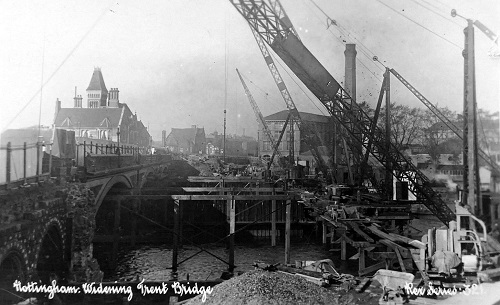
1924: Widening of Trent Bridge
1925: Wilford Power Station was opened on 17th September 1925 by Sir John Snell, the Chairman of the Electricity Commissioners. By 1928, further plants had been commissioned. On the 7th of November 1928, Sir Andrew Duncan, the Chairman of the Central Electricity Board, inaugurated a new 20,000 kW set at the North Wilford station. The station then had a continuous rating of 58.5 MW and a maximum rating of 71 MW. The total cost of the station was then £1,050,000. The Electricity Commissioners scheduled Wilford as a ‘selected’ station. Wilford Power Station was decommissioned in 1980 and is now the Riverside Trading Estate.
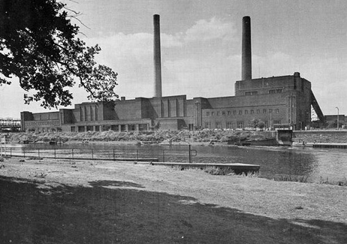
Wilford Power Station
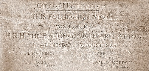
1927: The classical triumphal arch known as the Memorial Arch, which is grade II listed, was designed by the city engineer and surveyor, Mr T Wallis Gordon. Built of Portland stone, the memorial consists of a three-span archway flanked by colonnades, with a terrace overlooking the Gardens and the River Trent. The foundation stone was laid by the Prince of Wales on 1 August 1923, and the Arch was unveiled and dedicated on Armistice Day, the 11th of November 1927, by the Mayor of Nottingham, Ald. Edmund Huntsman.

1932 Flooding: Water passed beyond the regular water mark - it reached the Midlands Railway station 1.5 miles from the River Trent.
War Memorial, Victoria Embankment
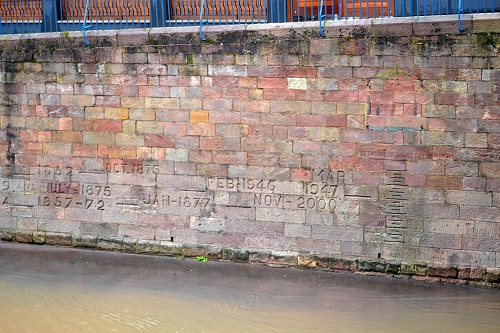
Victoria Embankment: Engraved into the wall the years when there was severe flooding in Nottingham, when the River Trent burst its banks. This photograph was taken in 2012 when the River burst its banks during severe flooding.
1939: Sunday September 3rd 11:15 the Prime Minister Neville Chamberlain broadcasts to the nation that World War II has broken out.
It was a war that was to last for six years and result in an estimated 70 to 85 million fatalities, making it the deadliest conflict in human history.
To hear the Prime Minister, Neville Chamberlain’s speech to the nation on Sunday 3rd September 1939, click on the above illustration.
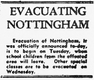
1939 World War II Evacuations, September 1939: In September 1939, Nottingham experienced the first wave of evacuations as part of Operation Pied Piper, with children from inner city areas like The Meadows, Radford, Basford, Carrington, St. Ann's, Sneinton, and Colwick being sent to safer areas in Nottinghamshire. Many Nottinghamshire villages, including Plumtree, Keyworth, Kimberley, Lambley, and Lowdham, received evacuees. While many returned home during the Phoney War, the experience of being an evacuee varied, with some having positive experiences while others faced hardship and mistreatment.
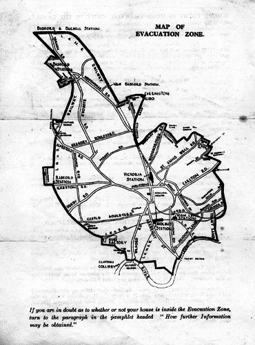
Map of Evacuation
Map of Evacuation

Evacuees arrive at Bingham Station

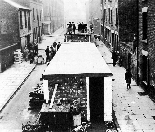
1939: Construction of a communal air raid shelter in the Meadows
© Nottinghamshire Archives
1939, Date Unknown: King George VI visits the Royal Ordnance Factory (ROF) in Nottingham.


© N. Arthur, C. Hardy
© N. Arthur, C. Hardy
Nottingham Blitz 8th and 9th May 1941: Although Nottingham was bombed on only 11 occasions, and 179 people were killed and 350 injured, the worst air raid occurred on the night of the 8th and 9th May 1941 when 159 people including 31 children were killed and 274 injured.
On the night of the 8th and 9th May 1941, London Road, Sneinton, Colwick Road and Carlton Road suffered the most. Boots printing department in Station Street was destroyed, but the heaviest casualties were at the Co-Op bakery in Meadow Lane where 48 employees and members of the Home Guard were killed and another 20 injured. There was also a direct hit on a shelter in Dakeyne Street, Sneinton and St. John the Baptist Church, Leenside (Canal Street) was destroyed.


Wilford Hill Cemetery: Memorial to the 48 employees of the Co-Op Bakery along with members of the Home Guard who were killed as a result of a direct hit on the night of the 8th and 9th May 1941.
The still smouldering ruins of St. John Baptist Church Leenside (Canal Street)
© N. Arthur, C. Hardy
1943: King George VI and Queen Elizabeth visited Nottingham's Royal Ordnance Factory (ROF) in 1943. Specifically, the visit took place on March the 3rd 1943. The royal couple toured the factory as part of a larger effort to boost morale and support the war effort.
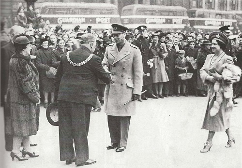
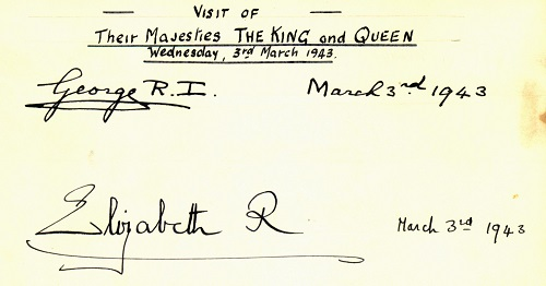
1943: March 3rd King George VI and Queen Elizabeth both being met outside the Council House, Nottingham by the Lord Mayor, Councillor Alderman and Mrs. Ernest A. Braddock.
© N. Arthur, C. Hardy
Their Majesties Signature, Lord Mayors Signature Book
8th May 1945: Victory in Europe (V.E. Day).


8th May 1945: V.E. Day: Crowds celebrate in Nottingham’s Old Market Square
8th May 1945: Headlines, Nottingham Evening Post
15th August, 1945: Victory Over Japan (VJ DAY). After six years of fighting (1939- 1945) World War II has finally ended.
1947 Flooding: The Nottingham floods of 1947 were caused by the melting of heavy snow following an exceptionally cold winter, which caused the River Trent to burst its banks. The floods affected a wide area, including the city centre, West Bridgford, and Beeston. In Nottingham city centre, 28 miles of streets, 3,000 properties, and 86 factories were flooded making it a particularly difficult time for residents who were still recovering from the aftermath of World War II.
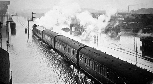

Headed by a steam engine, a train makes it's way through flood water in Nottingham 1947
Image: Nottingham Post
Queens Drive, Nottingham, is transformed into a lake in 1947 during the flooding
Image: Nottingham Post
1955: Built on the site of what was Colwick Weir, Colwick Sluice Gates spans the full width of the River Trent to the south of Nottingham and was built in the 1950s as part of a large-scale flood defence scheme that was officially opened by HRH Prince Philip on May the 5th 1955.

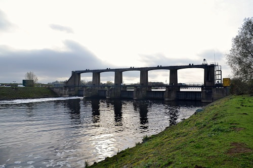
Colwick Weir
Colwick Sluice Gates
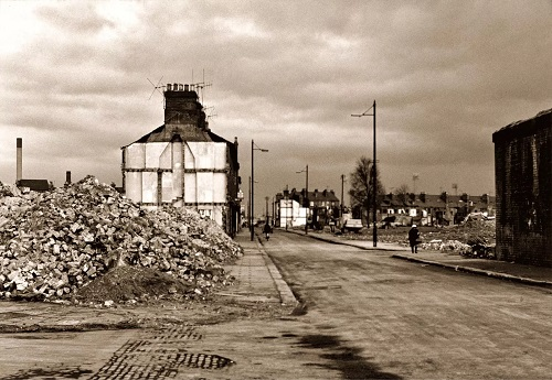
1970 – 1979 Meadows Redevelopment: Demolition of large sections of the Meadows which were deemed unsuitable for modern habitation occurred in the 1970s. However, one year before in 1969 Arkwright Street railway station closed permanently. It initially closed in 1963 when the Victoria Railway Station was closed but reopened again in 1967 only to close two years later when all passenger trains on the line were withdrawn

1975: Kirke White Street East looking towards Arkwright Street, The Meadows
Image: Picture Nottingham/Bernard And Pauline Heathcote Photographic Collection
1975: The rear of houses on Arkwright Street during demolition
Image: Picture Nottingham/Bernard And Pauline Heathcote Photographic Collection
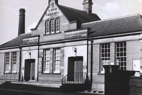
1974: The former Great Central Railway Goods and Parcels office on Queens Walk is purchased by the Nottingham City Council to be used as community centre.
1979: The Old Meadows after demolition had been completed.

2025: The Meadows Community Centre
1979: View from the Castle Rock after the demolition of the Old Meadows Estate
2001: The Royal Ordnance Factory in Nottingham closed in 2001 when armaments manufacturing was transferred to BAE Systems in Barrow-In-Furness. The Nottingham Royal Ordnance Factory (ROF) was a significant site for munitions production throughout the 20th century. It was known for its expertise in designing and manufacturing gun barrels and launch platform systems. The closure of ROF Nottingham was a subject of debate and concern, with some fearing a loss of vital defence manufacturing capabilities and technical expertise. At the time, the site's closure was part of a broader trend of Royal Ordnance Factory closures and consolidations across the UK.
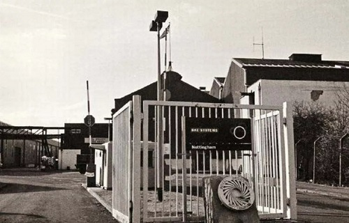

Royal Ordnance Factory pictured shortly before its closure in 2001
© Geoffrey Oldfield
NG2 is a 45-acre business park created from a brownfield site which was previously occupied by the Royal Ordnance Factory
2009 Meadows Ozone Energy Services (MOZES) was formed the group is a grassroots organisation that was formed by people who live in the Meadows. The group aims to tackle issues relating to fuel poverty and greenhouse gas emissions in the community. Funding was awarded from the Department of Energy and Climate Change in 2009 for the installation of solar photovoltaics on 55 houses, bringing renewable energy to the community.
2010: As part of a five-day tour of Britain's sustainable living projects, His Majesty King Charles III then, as the Prince of Wales visited the Meadows in Nottingham on Thursday the 9th of September 2010 where he launched an East Midlands sustainable business network and where he stopped off at a couple of regenerated faith centres and visited the home of a 70-year-old woman who had solar panels installed and wandered around the Arkwright Meadows Community Garden.
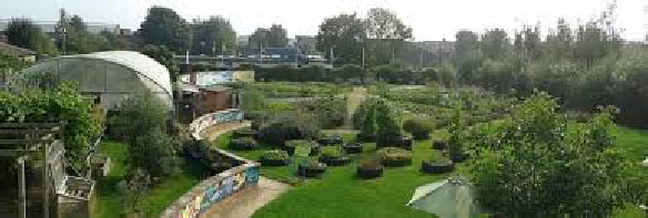
Arkwright Meadows Community Garden
© Facebook AMCG
2011 — 2014 Construction of New Tram Line: Construction of Phase Two started in 2012 although the plans had first been discussed as long ago as 2003 – before Phase One had even opened! The construction period suffered from delays – as major construction projects such as this often do – and the originally announced launch date of 14th December 2014 was missed with track laying not being finished until earlier in the same month. After eight more months of finishing works, testing and commissioning it was finally announced on 24th August that services would be commencing the following day and so it was on Tuesday 25th August 2015 that the residents of Clifton, Chilwell and places in between would be able to enjoy a ride. (http://www.britishtramsonline.co.uk)
Construction of Phase Two of Nottingham’s Tram Network


April 2013: The Bridge that would eventually become Nottingham Railway Station Tram Stop
September 2013: Construction of Nottingham Railway Station Tram Stop
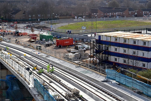

March 2014: The continuation of the construction of Phase Two of Nottingham’s Tram Network over Queen’s Drive
26 July 2014: The continuation of the construction of Phase Two of Nottingham’s Tram Network over Queen’s Drive
2012 – 2015 Green Street Sustainable Housing Project: The first phase of redevelopment commenced with phase 1 of Green Street, consisting of 38 low-energy use 3 and 4-bedroom residential properties. The second phase consisting of 22 low energy dwellings was completed in 2015.

Green Street 2 in The Meadows
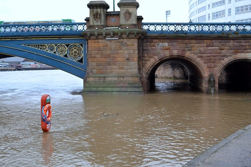
2012 Left Bank Flood Alleviation Scheme: The Nottingham Left Bank Flood Alleviation Scheme was a major project designed to reduce the risk of flooding to homes and businesses along the left bank of the River Trent. The scheme, which cost £45 million, now protects over 16,000 properties along a 27-kilometre stretch from Sawley to Colwick. It also enhances the protection of key infrastructure within the affected communities. The scheme aimed to reduce the risk of flooding to a 1 in 100 chance of occurring in any given year.
The scheme included various flood defence structures such as: Raising and rebuilding flood embankments, constructing new flood walls, raising roads to cross over the defences, and replacing flood gates.
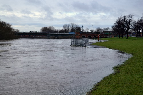
2012: Trent Embankment, Examples of Flooding and the breach of flood defences, Wilford and Trent Bridge
2013 Tree Carvings, Queens Walk: Over 40 lime trees were felled along Queens Walk in Nottingham as part of the new tram route extension. This occurred in 2012 as part of the Nottingham Express Transit (NET) Phase Two development. While some residents were saddened by the loss of the mature trees, the city council stated that the tree removal was necessary for the tram line construction. As part of a mitigation strategy, Nottingham City Council, together with the Meadows Partnership Trust, planned to utilise the felled trees by turning them into carvings, benches, and play equipment. Specifically, 12 sculptures, themed around the local community, were created from the lime trees.

May 23rd 2025 The Children’s Paddling Pool Reopens: The historic feature dating back 97 years to 1928 after an absence of four years due to water leaks was finally reopened with features such as a splash pad with water jets of differing height and strength and tunnels making it suitable for a range of ages.
The restoration was financed by the National Lottery Heritage Fund, Section 106 contributions, and government levelling up funds. The design was shaped by local consultation, where people asked for a mixture of traditional paddling pool and modern water play elements.
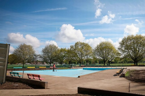
Restored Paddling Pool, Victoria Embankment
© Joseph Raynor/ Reach PLC
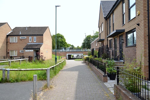
The Meadows 2025

Queens Walk Tram Stop
Walkway between Queens Walk and Bridgeway Centre
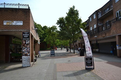

Bridgeway Centre
Meadows Way